Founder of Trace Taiwan. Most of the Traces you can find attached to my profile will be located fairly close to Taipei. Many of these can be completed in a single day if your willing to get up early.
-
Jay
River:
三棧溪 / Sanzhan riverArea:
HualienRegion:
EastStart:
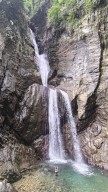
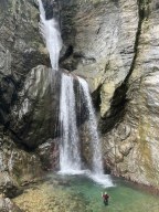
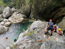
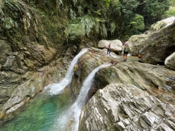
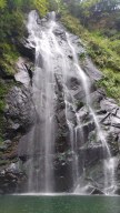
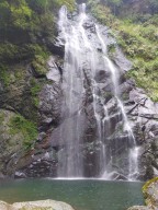
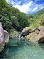
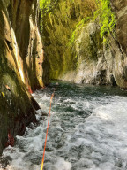
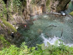
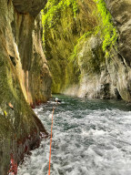
24.10787,121.59976The 5-kilometer one-way hike was quite long. We walked almost non-stop and chose to stick to the trail as much as possible while strictly limiting our time to 5 or 10 minutes at each large pool. To save time, we followed the trail for most of the route to Double Dragon Waterfall rather than tracing in the water. From Double Dragon to the final 120-m ... eter waterfall, the creek became steeper and more challenging, requiring us to climb large rocks, which slowed us down. There were no technical difficulties, but it demanded physical stamina and strict time management. We spent a fair amount of time at each large pool, but we decided to skip the Double Dragon pool and its slide. On our way back, we jumped into the pools (having checked their depth and suitable jump spots on our way up). We passed all the commercial tours and were rewarded with the opportunity to filter and drink the creek water, which tasted great. Most of them only reached the first large pool, and only a few made it to Crimson Gorge. Before reaching the final waterfall, we encountered a slender and elegant 60-meter waterfall and another tall one. Then came the enormous final 120-meter waterfall. It deserved a spot in my top ten magnificent waterfalls list, alongside the 120-meter Nenggao Soaring Falls. I had initially thought it would be around 70 meters based on the topo map, but I was glad to be proven wrong—very wrong. The waterfall consisted of three tiers, resembling the cross-section of a pork belly. The creek water from the main stream rushed from the top of the waterfall to the next tier, then further down to another tier before finally reaching the enormous pool it had created. The waterfall gorge had a beautiful shape, surrounded by steep mountainsides. A giant boulder served as the waterfall's threshold, which we had to climb over to access the pool, accompanied by a secondary 10-meter waterfall between the boulder itself and the giant pool. This trace was one of the most enjoyable and rewarding experiences I've had so far. It appears that there was another waterfall over 100 meters high about 300 meters away. Hopefully, someone can bring a drone to check it out. Trailhead 24.10787,121.59976 Rose Valley 玫瑰谷 24.11162,121.59199 Crimson Valley 赤金峽谷 24.11639,121.58093 Double Dragon 雙龍瀑布 24.11679,121.57702 Gorge 24.11692,121.57491 120-M Pork Belly Waterfall 24.12026,121.57353 -
Jay
River:
宇內溪 / Yunei riverArea:
TaoyuanRegion:
NorthStart:
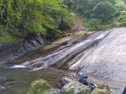
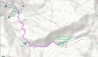
24.798278566799212, 121.418041988440311. This trace does not include the famous Yunei Slide (這裡不是宇內溪滑水道). The slide on this route is different from the well-known one. It can be confusing because both slides are in the same creek, but they are far apart, making it unlikely to visit both in a single trace. (The famous one: 24.790678871183513, 121.39577197890424) 2.!The GPS pin of White V ... eil Waterfall on Google Map is WRONG! The correct one is the one on our ending GPS. 3.Baisha Waterfall/White Veil Waterfall (白紗瀑布) is a serene and beautiful waterfall, standing at approximately 40 meters tall, with a large pool perfect for swimming. Above it, you can find Hewei Waterfall (赫威瀑布); to reach it, walk around on the left side. Further up, you can access the Hewei Divine Tree Area. 4.To embark on this river trace, it is safest to obtain the permit 5-60 days in advance from Chatianshan Nature Reserve (插天山保護區). The trailhead starts through a private farm residence called "Kapu No.17" (卡普17號). The parking fee at the residence should be around 100 NTD. Once you pay for your parking, the owner probably wouldn't bother to check if you have the permit. 5.To get to White Veil Waterfall, walk down the farm, and you'll reach a small stream soon. Cross the stream, and you'll find a hiking trail. The trail first goes around the mountainside, then stretches along the creek and eventually touches the creek. On the lateral part, the trail sometimes goes by the creek and sometimes merges in the creek. Finally, the trail completely disappears, and you can only river trace in the creek to the waterfall. 6.The creek is VERY SLIPPERY. Be extremely cautious while walking in the river. 7. Water Slide Location: 24.789783, 121.420900 Be very careful with this water slide. It is extremely slipper. Make sure to clear your path before you slide. I almost fucked myself up on a big sharp rock in the water but miraculously only got a scratch. -
Jay
River:
合流溪 / Heliu creekArea:
YilanRegion:
EastStart:
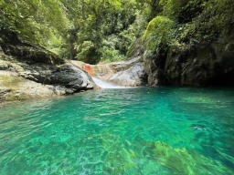
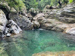
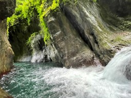
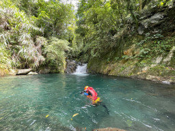
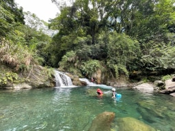
24.42377,121.70887Heliu Creek is a beautiful creek with countless pools and is a must for river tracers. The pools are pristine and emerald, and many of which are able to be jumped into. Quite a few pools have waterslides, and an abundance of natural bouldering walls can be found along the creek. Near the end of the trace is a 6-meter waterfall and its huge pool. Aft ... er the waterfall is there a short gorge that connects to the Ending GPS on this post. The creek intersects with Nan'ao Old Trail, and it takes 1 hour from the trailhead to the river. Parking spaces are around the trailhead. Heliu Waterfall (12M): 24.42974,121.69213
